
2008 edition (10/07); 2009 edition (10/08).
| Post-War Road Maps and Atlases | |
| Roads 1946 to1955. 1:625 000 scale. | ||
| Sheet 1 | 24046 (1946). | |
| Sheet 2 | 25046 (1946); 3817 (1948). | |
| Roads 1956 to 1963. 1:625 000 scale. | ||
| Sheet 1 | nc:A (1956); B:A (1963). | |
| Sheet 2 | nc:A (1956). | |
| Route Planning Map 1964 to 1992. 1:625 000 scale. | ||
| Sheet 1 | A (1964). | |
| Sheet 2 | A (1964); A/ (1964). | |
| North Sheet | B (1965); C (1966); D (1967); E (1967); F (1968); G (1969); H (1970); J(1971); K (1972); L (1973); M (1974); N (1975); P (1976); Q (1977); R (1978); S (1979); T (1980); U (1981); V (1982); W (1983); X (1984); Y (1985); Z (1986); AA (1988); BB (1991). | |
| South Sheet | B (1965); B/* [1965]; C (1966); D (1967); E (1967); F (1968); G (1969); H (1970); J (1971); K (1972); K/* (1972); L (1973); M (1974); N (1975); P (1976); Q (1977); R (1978); S (1979); T (1980); U (1981); V (1982); W (1983); X (1984); Y (1985); Z (1986) AA (1988); BB (1991). | |
| Back to Back | L (1973); M (1974); N (1975); P (1976); Q (1977); R (1978); S (1979); T (1980); U (1981); V (1982); W (1983); X (1984); Y (1985); Z (1986); AA (1988); BB (1991). | |
| Travelmaster 1993 to 2000. 1:625 000 scale. | ||
| Sheet 1 | A (1993); B (3/97); C (3/99). | |
| Great Britain Routeplanner 2000 to 2001. 1:625 000 scale. | ||
| 2001 edition A (11/00); 2002 edition [B?] (10/01). | ||
| Great Britain Route Map 2002 to 2010. 1:625 000 scale. | ||
| 2003 edition (7/02); 2004 edition (9/03); 2005 edition (10/04); 2006 edition (10/05); 2007 edition (10/06); 2008 edition (10/07); 2009 edition (10/08). | ||
| Publication discontinued March 2010. | ||
| Great Britain, OS. 1:550 000 scale. | ||
| 2017 edition (3/17). | ||
| Fifth Series 1957 to 1978. 1:250 000 scale. | ||
|
|
||
| 1 | Orkney and Shetland Islands | A (9/62), A/ [2/67], A// [2/72]; B (8/74). |
| 2 | North West Scotland | A (11/62); B (9/66), B/ [12/70]; C (2/73), C/* (7/75). |
| 3 | Northern Scotland | A (8/62); B (9/66), B/* (3/71); C (5/73), C/* (1973). |
| 4 | Western Highlands | A (12/61), A/ [7/64]; B (4/67), B/* (4/71); C (6/74); D (6/78). |
| 5 | Eastern Highlands | A (2/62),& A/ [5/63]; B (6/67), B/ [1/71]; C (4/74); D (12/78). |
| 6 | Firth of Clyde | A (12/61); B (3/65), B/* (3/68), B/*/* (4/71); C (2/74), C/* (10/75); D (9/78). |
| 7 | Firth of Forth | A (5/61); B (8/64), B/* (8/67); C (7/69), C/* (3/72); D (10/73), D/* (9/75). |
| 8 | Solway Firth | A (4/60); B (1/63); C (3/66), C/ [6/71], C//* [3/72]; D (12/74). |
| 9 | North East England | A (5/60); B (2/64), B/* (3/66), B/*/* (3/68); C (5/70), C/* (3/72); D (11/73), D/* (9/75). |
| 10 | North Wales and Lancashire | A (4/57); B (10/62); C (5/66), C/ [10/67]; D (7/69), D/* (1/71), D/*/* (12/71); E (2/73), E/* (11/73), E/*/* (12/74); F (3/76). |
| 11 | North Midlands and Yorkshire | A (3/60); B (7/64), B/* (10/66); C (11/67), C/* (3/69), C/*/* (4/70), C/*/*/* (12/70), C/*/*/*/* (1/72); D (5/73), D/* (7/74), D/*/* (6/75); E (6/77). |
| 12 | South Wales | A (3/60), A/* (7/64); B (3/67), B/* (7/69), B/*/* (2/71); C (2/73), C/* (11/74). |
| 13 | The Midlands | A (5/62); B (11/65), B/* (7/67); C (7/68), C/* (5/70), C/*/* (4/71), C/*/*/* (2/72); D (2/73), D/* (1/74), D/*/*(12/74); E (3/76). |
| 14 | East Anglia | A (4/62), A/* (4/65); B (2/66); C (5/70); D (2/74); E (10/77). |
| 15 | South West England | A (11/62); B (6/66), B/* (4/69); C (5/72), C/* (11/74). |
| 16 | Southern England | A (1/63); B (9/66), B/* (10/67), B/*/* (11/68); C (6/70), C/* (3/71), C/*/* (5/72); D (2/73), D/* (2/74), D/*/* (6/75); E (12/76). |
| 17 | South East England | A (1/63); B(10/66), B/* (12/67), B/*/* (3/69); C (6/70), C/* (4/71), C/*/* (3/72); D (2/73), D/* (6/74), D/*/* (6/75); E (12/76). |
| Wales and the Marches | A (8/59), A/ (1959); B (4/63), B/* (7/67); C (4/71); D ( /76). | |
| Routemaster Series 1978 to 1993. 1:250 000 scale. | ||
| 1 | Orkney, Shetland and the Western Isles | A (6/79); B (5/82); C (4/85); D ( /88). |
| 2 | Northern Scotland | A (6/79); B (8/81); C (10/83); D (4/85); E (9/87); F (1/90). |
| 3 | Western and Central Scotland | A (6/79); B (1/82); C (7/83); D (4/85); E (5/86); F (10/87); G (4/90). |
| 4 | Central Scotland and Northumberland | A (6/79); B (1/82); C (7/83); D (4/85); E (4/86); F (4/87); G (7/89). |
| 5 | Northern England | A (5/78); B (2/80); C (4/81); D (1/82); E (5/83); F (4/85); G (10/87); H (7/90). |
| 6 | East Midlands and Yorkshire | A (5/78); B (2/80); C (4/81); D (1/82); E (11/83); F (3/85); G (10/87); H (7/90). |
| 7 | Wales and the West Midlands | A (5/78); B (2/80); C (4/81); D (2/82); E (8/83); F (4/85); G (5/86); H (9/87); J (1/90). |
| 8 | South West England and South Wales | A (5/78); B (2/80); C (7/81); D (5/82); E (6/83); F (3/85); G (8/87); H (1/90). |
| 9 | South East England | A (5/78); B (2/80); C (5/81); D (3/83); E (3/85); F [6/86]; G (3/87); H [1990?]; H1 (7/91). |
| Travelmaster Maps 1993 to 2001. 1:250 000 scale. | ||
| 2 | Northern Scotland, Orkney and Shetland | A (5/93); B (3/97); C (3/99). |
| 3 | Western Scotland and the Western Isles | A (5/93); B (12/95); C (3/97); D (3/99). |
| 4 | Southern Scotland and Northumberland | A (5/93); B (3/97); C (3/99). |
| 5 | Northern England | A (5/93); B (3/97); C (3/99). |
| 6 | East Midlands & East Anglia including London | A (5/93); B (3/97); C (3/99). |
| 7 | Wales and West Midlands | A (Sp/93); B (3/97), B/ (10/97); C (3/99). |
| 8 | South West England and South Wales | A (5/93); B (3/97); C (3/99). |
| 9 | South East England including London | A (5/93); B (3/97); C (3/99). |
| Road Maps 2001 to 2010. 1:250 000 scale. | ||
| 1 | Northern Scotland , Orkney & Shetland | A (4/01); B (2/03); C (3/05); D (3/07); E (3/09). |
| 2 | Western Scotland & the Western Isles | A (4/01); B (2/03); C (3/05); D (3/07); E (3/09). |
| 3 | Southern Scotland & Northumberland | A (4/01); B (2/03); C (3/05); D (3/07); E (3/09). |
| 4 | Northern England | A (4/01); B (2/03); C (3/05); D (3/07); E (3/09). |
| 5 | East Midlands & East Anglia including London | A (4/01); B (3/03); C (3/05); D (3/07); E (3/09). |
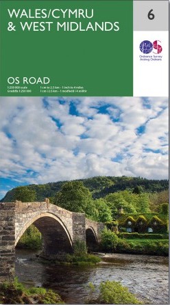
| 6 | Wales & West Midlands | A (4/01); B (2/03); C (3/05); D (3/07); E (3/09). |
| 7 | South West England & South Wales | A (4/01); B (2/03); C (3/05); D (3/07); E (3/09). |
| 8 | South East England including London | A (4/01); B (2/03); C (3/05); D (3/07); E (3/09). |
| Publication discontinued March 2010. | ||
| OS Road Maps 2016. 1:250 000 scale. Current series. | ||
| 1 | Northern Scotland , Orkney & Shetland | 2016 (9/16); 2020 (1/20); 2023 (2/24). |
| 2 | Western Scotland & the Western Isles | 2016 (9/16); 2020 (1/20); 2023 (5/24). |
| 3 | Southern Scotland & Northumberland | 2016 (9/16); 2020 (1/20); 2023 (3/24). |
| 4 | Northern England | 2016 (9/16); 2020 (1/20); 2023 (6/24). |
| 5 | East Midlands & East Anglia including London | 2016 (9/16); 2020 (1/20); 8/25 (8/25). |
| 6 | Wales & West Midlands | 2016 (9/16); 2020 (1/20); 2023 (5/24). |
| 7 | South West England | 2016 (9/16); 2020 (1/20); 2023 (8/24). |
| 8 | South East England including London | 2016 (9/16); 2020 (1/20); 2003 (6/25). |
| ORDNANCE SURVEY ROAD ATLASES | ||
| Main scale 1:250 000 | ||
| Ordnance Survey Atlas of Great Britain | ||
| First published 1982; revised edition, published 1989. | ||
| Road Atlas of Great Britain | ||
| First published 1983; 2nd edition, published 1986; 3rd edition, published 1988; 4th edition, published 1990; 5th edition, published 1992; 6th edition, published 1994. | ||
| Main scale 1:190,080 | ||
| Motoring Atlas of Great Britain | ||
| First published 1983; 2nd edition, published 1985; 1986 (3rd) edition, published 1986; 1987 (4th) edition, published 1986; 1988 (5th) edition, published 1987; 1989 (6th) edition, published 1988; 1990 (7th) edition, published 1989;1991 (8th) edition, published 1990; 1992 (9th) edition, published 1991; 1993 (10th) edition, published 1992; 1994 (11th) edition, published 1993; 1995 (12th) edition, published 1994; 1996 (13th) edition, published 1995; 1997 (14th) edition, published 1996; 1998 (15th) edition, published 1997; 1999 (16th) edition, published 1998; 2000 (17th) edition, published 1999; 2001 (18th) edition, published 2000; and yearly thereafter by Philip's. | ||
| Road Atlas of Great Britain | ||
| First published 1983; 2nd edition, published 1986; 3rd edition, published 1988; 4th edition, published 1990; 5th edition, published 1992; 6th edition, published 1994. | ||
| Touring Atlas of Great Britain | ||
| First published 1987; 2nd edition, published ?1988; 3rd edition, published ?1989; 4th edition, published 1990. | ||
| Main scale 1:140,000 | ||
| Superscale Atlas of Great Britain | ||
| First published 1993; 2nd edition, published 19??; 3rd edition, published 1998; 4th edition, published 1999. | ||
| The author - Leslie (Lez) V Watson - has asserted his right under the Copyright, Designs and Patents Act, 1988, to be identified as the author of this work. I use Visual Studio Code & Notepad++ script editors, and Firefox web browser. ♣ 10.15 :: March 2026 |
| Website v20.5 :: March 2026 |